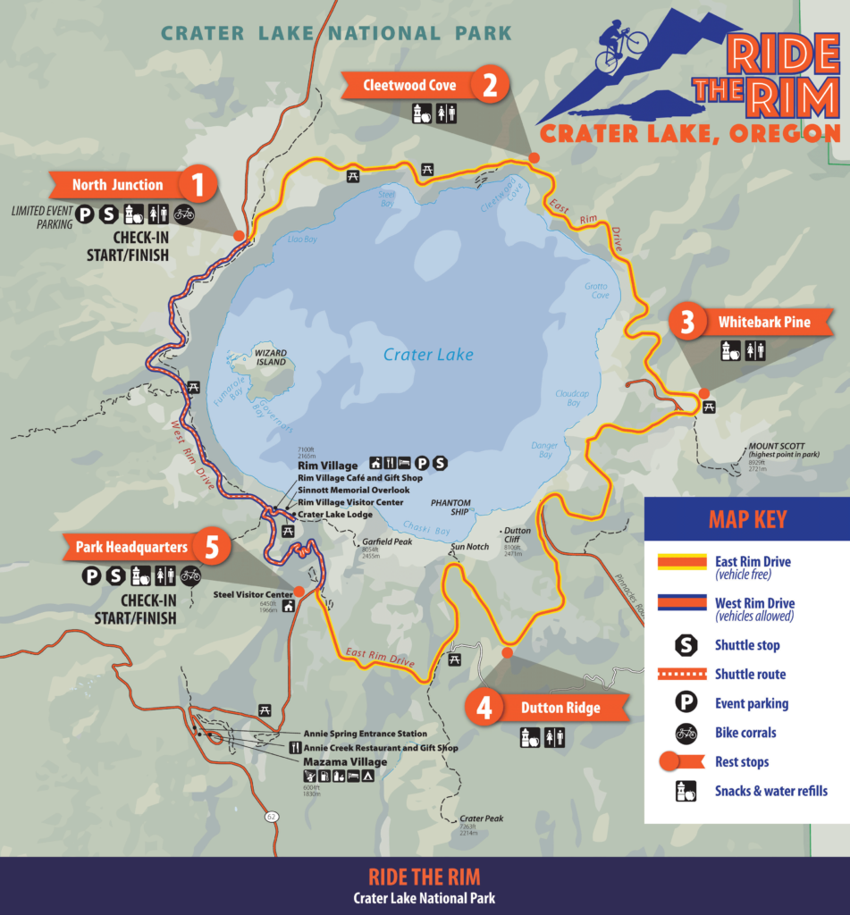
Although the entire Rim Drive can be traversed, only the East Rim section (highlighted by the red line) is designated for vehicle-free travel. The remaining West Rim Drive accommodates vehicles (indicated by the yellow line in the Full Route Map). The shuttle travels along the West Rim between North Junction and Park HQ throughout the event. Please make the necessary preparations with this information in mind.
If you find the elevation of the complete route challenging, you may opt for an out-and-back journey starting from either North Junction or Park HQ. Utilize the provided maps below to assist you in planning your desired route.

